
Sky Eye Imagery · Aylesbury & beyond
Drone services in Aylesbury and Buckinghamshire.
Aerial photography, filming, inspection imagery and mapping
across Buckinghamshire, London and the Home Counties.
Looking for drone services in Aylesbury? Sky Eye Imagery helps
homeowners, businesses, estate agents and construction teams
capture the views and information they need. From roof photographs
and property videos to thermal imagery and aerial mapping, each
flight is planned around your location, project and required results.
Based in Aylesbury, Bitu Williams provides a personal service from
the initial discussion through to delivery of your imagery.
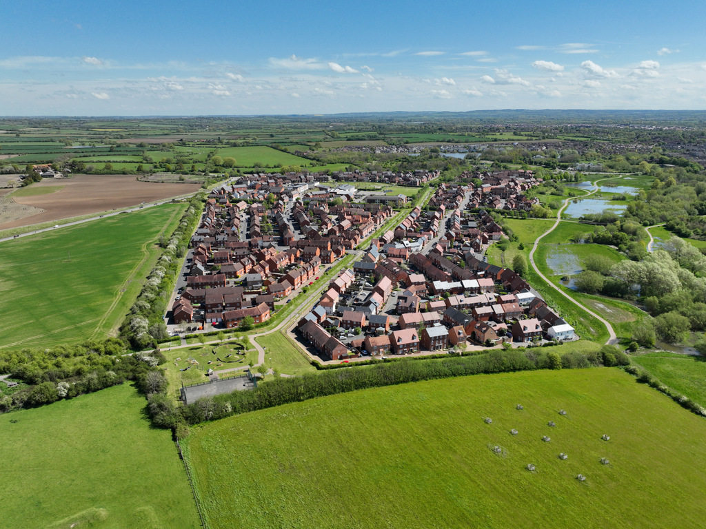
Choose the right drone service for your project
Aerial photography and drone videography
Show your property, business or location from a different
perspective. Aerial photographs and video can reveal a building’s
setting, showcase outdoor spaces and create engaging material for
websites, social media and marketing campaigns.
Discuss whether you need edited photographs, individual video
clips or a finished promotional film. Image formats, editing and
delivery requirements are agreed before the shoot.
Explore aerial photography
or
find out about drone videography
.
Drone roof and building inspection imagery
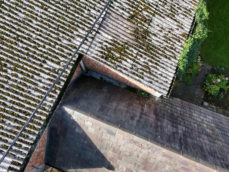
Get a closer view of roofs, gutters, chimneys and other
hard-to-reach parts of a building. Drone imagery can help
homeowners, property managers and contractors document visible
damage and identify areas that need further investigation.
A roof image reference pack gives you a visual record to share
with your roofer or qualified surveyor. This service provides
inspection imagery; it does not replace a structural survey or
specialist diagnosis.
Drone mapping and 3D models
Capture aerial datasets for land, development sites and existing
buildings. Drone mapping can support site planning, project
documentation and visualisation through orthomosaic images and
photogrammetry-based 3D models.
We agree the area to cover, intended use, required resolution and
output formats before capture. Where measurements matter,
accuracy requirements and verification methods must also be
agreed for the project.
Thermal drone imagery
Thermal cameras reveal surface temperature differences that are
not visible in ordinary photographs. Thermal imagery can support
investigations into heat loss, building performance and other
temperature-related concerns.
Capture conditions and the purpose of the inspection are discussed
in advance. Thermal anomalies can highlight areas for
investigation, but do not establish the cause of a problem on
their own.
Construction progress and property marketing
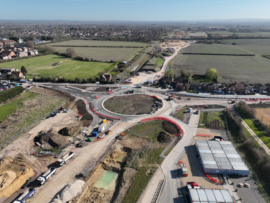
Give clients, contractors and stakeholders a clear overview of
your site. Aerial photographs and video can document construction
progress, show the relationship between buildings and surrounding
land, and support project updates.
For estate agents and property owners, combine exterior aerial
views with property footage to show the layout, setting and
features that matter to prospective buyers or tenants.
FPV filming, events and venue flythroughs
Bring viewers into your space with an immersive FPV drone
flythrough. Indoor property tours and venue films can connect
rooms and spaces in a flowing sequence, helping audiences
understand the layout and atmosphere.
Outdoor event filming can add aerial context to sporting,
community and business events. Every project is assessed for
suitability, with flight planning taking account of people, the
location and any permissions needed.
Work directly with an experienced drone operator
Sky Eye Imagery is led by Bitu Williams, a GVC-qualified drone pilot
with 24 years of Royal Air Force service, a Level 4 Diploma in remote
piloting and specialist thermography qualifications.
Your project starts with a discussion about what you need to see,
show or document. Bitu then assesses the location, plans the capture
and agrees the deliverables with you.
- Flight planning based on the site and task.
- Clear agreement on imagery, editing and output formats.
- A quote tailored to your project and location.
- Direct communication with the person carrying out the work.
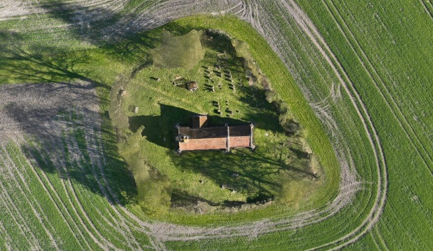
A view of the work
Real places. Clearer detail.
Drone services across Aylesbury, Buckinghamshire and beyond
Based in Aylesbury, Sky Eye Imagery serves clients across
Buckinghamshire, including Amersham, Chesham, High Wycombe and
Milton Keynes. Projects are also undertaken in London and surrounding
areas, including Bicester, Oxford, Hemel Hempstead, St Albans and
Watford.
Send your site postcode and a short description of the work to check
availability. Travel requirements and any additional planning are
considered when preparing your quote.
How to book your drone project
-
Tell us about the task.
Share the location, preferred date and the images, footage or
data you need. -
Receive a tailored quote.
We review the site and agree the scope, deliverables and timing. -
Plan the flight.
Site conditions, airspace, permissions and weather are assessed
before work goes ahead. -
Receive your results.
Your agreed imagery or datasets are prepared and delivered in the
agreed format.
Drone services questions
How much do drone services in Aylesbury cost?
The cost depends on the location, time on site, planning, editing
and outputs required. View the
drone hire rates
for package information, or request a quote for your specific task.
Can you photograph my roof without scaffolding?
A drone can often capture roof imagery without scaffolding.
Suitability depends on access, nearby obstacles, airspace and the
ability to carry out the flight safely. Share your property
location so the task can be assessed.
What happens if the weather is unsuitable?
Flights depend on suitable weather and site conditions. If
conditions prevent safe or useful capture, we will discuss
rescheduling with you.
What will I receive after the flight?
Your deliverables are agreed in the quote. Depending on the
service, these may include edited photographs, video clips, a
finished film, a roof image reference pack, thermal images or
mapping datasets.
How quickly can you carry out a project?
Availability depends on the location, weather, flight planning and
any permissions required. Send your preferred date and site
postcode so we can advise on a realistic schedule.
Get a free drone services quote
Tell Bitu what you need to capture, where the project is based and
when you need it. Include your site postcode and any specific image,
video or data requirements.
Call:
07745 966840
Email:
info@skyeyeimagery.com
Use the enquiry form below to send your project details.
Sky Eye Imagery · Aylesbury & beyond
Drone services in Aylesbury and Buckinghamshire.
Aerial photography, filming, inspection imagery and mapping across Buckinghamshire, London and the Home Counties.
Looking for drone services in Aylesbury? Sky Eye Imagery helps homeowners, businesses, estate agents and construction teams capture the views and information they need. From roof photographs and property videos to thermal imagery and aerial mapping, each flight is planned around your location, project and required results.
Based in Aylesbury, Bitu Williams provides a personal service from the initial discussion through to delivery of your imagery.
Choose the right drone service for your project
Aerial photography and drone videography
Show your property, business or location from a different perspective. Aerial photographs and video can reveal a building’s setting, showcase outdoor spaces and create engaging material for websites, social media and marketing campaigns.
Discuss whether you need edited photographs, individual video clips or a finished promotional film. Image formats, editing and delivery requirements are agreed before the shoot.
Explore aerial photography or find out about drone videography .
Drone roof and building inspection imagery
Get a closer view of roofs, gutters, chimneys and other hard-to-reach parts of a building. Drone imagery can help homeowners, property managers and contractors document visible damage and identify areas that need further investigation.
A roof image reference pack gives you a visual record to share with your roofer or qualified surveyor. This service provides inspection imagery; it does not replace a structural survey or specialist diagnosis.
Drone mapping and 3D models
Capture aerial datasets for land, development sites and existing buildings. Drone mapping can support site planning, project documentation and visualisation through orthomosaic images and photogrammetry-based 3D models.
We agree the area to cover, intended use, required resolution and output formats before capture. Where measurements matter, accuracy requirements and verification methods must also be agreed for the project.
Thermal drone imagery
Thermal cameras reveal surface temperature differences that are not visible in ordinary photographs. Thermal imagery can support investigations into heat loss, building performance and other temperature-related concerns.
Capture conditions and the purpose of the inspection are discussed in advance. Thermal anomalies can highlight areas for investigation, but do not establish the cause of a problem on their own.
Construction progress and property marketing
Give clients, contractors and stakeholders a clear overview of your site. Aerial photographs and video can document construction progress, show the relationship between buildings and surrounding land, and support project updates.
For estate agents and property owners, combine exterior aerial views with property footage to show the layout, setting and features that matter to prospective buyers or tenants.
FPV filming, events and venue flythroughs
Bring viewers into your space with an immersive FPV drone flythrough. Indoor property tours and venue films can connect rooms and spaces in a flowing sequence, helping audiences understand the layout and atmosphere.
Outdoor event filming can add aerial context to sporting, community and business events. Every project is assessed for suitability, with flight planning taking account of people, the location and any permissions needed.
Work directly with an experienced drone operator
Sky Eye Imagery is led by Bitu Williams, a GVC-qualified drone pilot with 24 years of Royal Air Force service, a Level 4 Diploma in remote piloting and specialist thermography qualifications.
Your project starts with a discussion about what you need to see, show or document. Bitu then assesses the location, plans the capture and agrees the deliverables with you.
- Flight planning based on the site and task.
- Clear agreement on imagery, editing and output formats.
- A quote tailored to your project and location.
- Direct communication with the person carrying out the work.
A view of the work
Real places. Clearer detail.
Drone services across Aylesbury, Buckinghamshire and beyond
Based in Aylesbury, Sky Eye Imagery serves clients across Buckinghamshire, including Amersham, Chesham, High Wycombe and Milton Keynes. Projects are also undertaken in London and surrounding areas, including Bicester, Oxford, Hemel Hempstead, St Albans and Watford.
Send your site postcode and a short description of the work to check availability. Travel requirements and any additional planning are considered when preparing your quote.
How to book your drone project
- Tell us about the task. Share the location, preferred date and the images, footage or data you need.
- Receive a tailored quote. We review the site and agree the scope, deliverables and timing.
- Plan the flight. Site conditions, airspace, permissions and weather are assessed before work goes ahead.
- Receive your results. Your agreed imagery or datasets are prepared and delivered in the agreed format.
Drone services questions
How much do drone services in Aylesbury cost?
The cost depends on the location, time on site, planning, editing and outputs required. View the drone hire rates for package information, or request a quote for your specific task.
Can you photograph my roof without scaffolding?
A drone can often capture roof imagery without scaffolding. Suitability depends on access, nearby obstacles, airspace and the ability to carry out the flight safely. Share your property location so the task can be assessed.
What happens if the weather is unsuitable?
Flights depend on suitable weather and site conditions. If conditions prevent safe or useful capture, we will discuss rescheduling with you.
What will I receive after the flight?
Your deliverables are agreed in the quote. Depending on the service, these may include edited photographs, video clips, a finished film, a roof image reference pack, thermal images or mapping datasets.
How quickly can you carry out a project?
Availability depends on the location, weather, flight planning and any permissions required. Send your preferred date and site postcode so we can advise on a realistic schedule.
Get a free drone services quote
Tell Bitu what you need to capture, where the project is based and when you need it. Include your site postcode and any specific image, video or data requirements.
Call:
07745 966840
Email:
info@skyeyeimagery.com
Use the enquiry form below to send your project details.