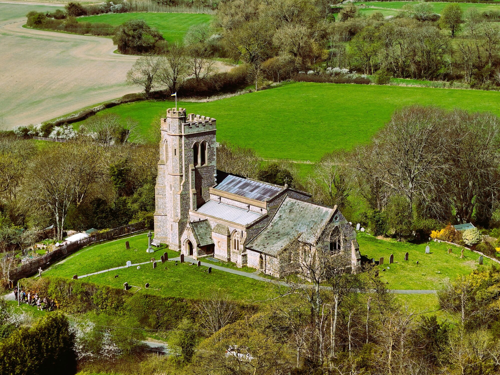
Short Creative Capture
From £150 – Professional aerial photography & cinematic video. Transform your vision into breath-taking visuals. We combine CAA‑licensed expertise with cinematic storytelling to deliver imagery that promotes your brand, property, or event.
Includes:
- CAA‑licensed pilot & insured operations
- Pre‑flight creative planning & risk assessment
- Up to 30 minutes on site
- At least eight professionally edited high‑resolution images/video clips
- Cinematic 1080p – 6K video clips
- Fast, secure digital delivery (RAW/DNG available)
Perfect for: Property showcases · Brand launches · Social media content · Basic planning images
Creative Capture
£Request Quote – Professional aerial photography & cinematic video. Transform your vision into breath-taking visuals. We combine CAA‑licensed expertise with cinematic storytelling to deliver imagery that promotes your brand, property, or event.
Includes:
- CAA‑licensed pilot & insured operations
- Pre‑flight creative planning & risk assessment
- Up to 1 hour on site
- At least 15 professionally edited high‑resolution images/video clips
- Cinematic 1080p – 6K video clips
- Fast, secure digital delivery (RAW/DNG available)
Perfect for: Luxury property showcases · Tourism campaigns · Brand launches · Social media reels · Construction sites
Drone Livestream Meeting, Event, Sports Spotlight
£Request Quote – Live drone streaming. Bring your audience into the action in real time. We stream directly to YouTube or other platforms, with optional live commentary integration.
Includes:
- Multi‑angle live aerial coverage
- Real‑time broadcast to chosen platform
- Live commentary/audio feed integration
- Up to 35 minute stream between battery changes, extra time is discounted
- High performance mobile WiFi for stable transmission
Perfect for: Sports events · Festivals · Corporate launches · Teams and Zoom meetings
Half Day Powerhouse
£ Request Quote – Half‑day unlimited creative capture. Four hours of uninterrupted aerial creativity. Multiple locations, multiple styles from cinematic fly‑throughs to dramatic reveal shots.
Includes:
- Unlimited photos & video clips during the session
- Multiple location setups within range
- 60‑day secure media storage
- All media delivered in high‑res formats
- Additional time is discounted
Perfect for: Event coverage · Developers · Destination marketing · Event highlight reels
UAV Drone Inspection Photography
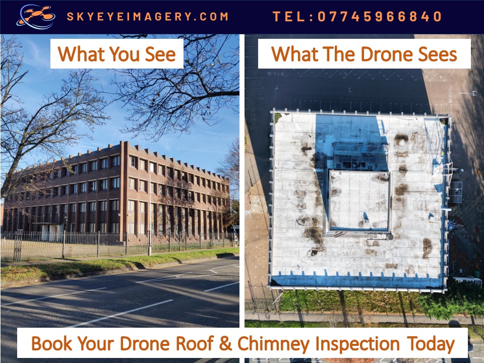
Hire rate includes normal pre-flight planning paperwork. Product delivered within pre-arranged timeframe. Imagery will highlight and label areas that might be of interest. The increase in price from the hourly rate includes the increased hazards of inspection imagery collection. Notably flying the UAV Drone much closer to a building at various angles and the onsite analysis required during a flight to obtain sufficient inspection imagery. Thermal IR imagery might also be included as standard if required for the inspection.
The Precision Eye
From £ 300 – Aerial inspection photography. Capture detailed inspection imagery and video of buildings, rooves, inaccessible areas. These can then be used for detailed analysis and inclusion into reports and submissions to third parties.
Includes:
- Unlimited images and video clips if required
- Delivered via secure link
- Optional thermal IR imagery
Perfect for: Roof & chimney inspections · Insurance claims · Contractor briefs
The Full Report
From £400 – Inspection + detailed report. A comprehensive visual and written record, ready for insurers, contractors, or compliance teams.
Includes:
- Annotated imagery
- Navigable HTML or PDF report
- Highlighted areas of interest
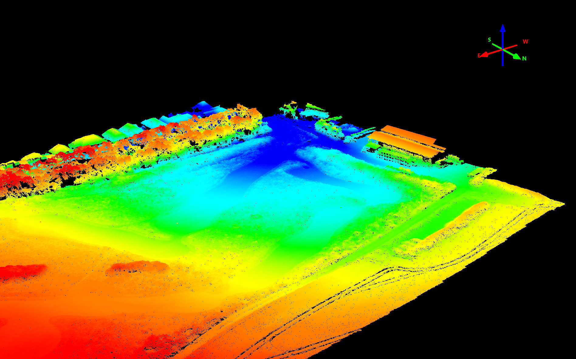
Specialist UAV Drone Mapping & Survey Services
Below rates are per task depending on size of area covered. Hire rate includes normal pre-flight planning paperwork.
Output includes point positioning and error threshold report, photogrammetry processing and relevant geospatial datasets that have been pre-agreed.
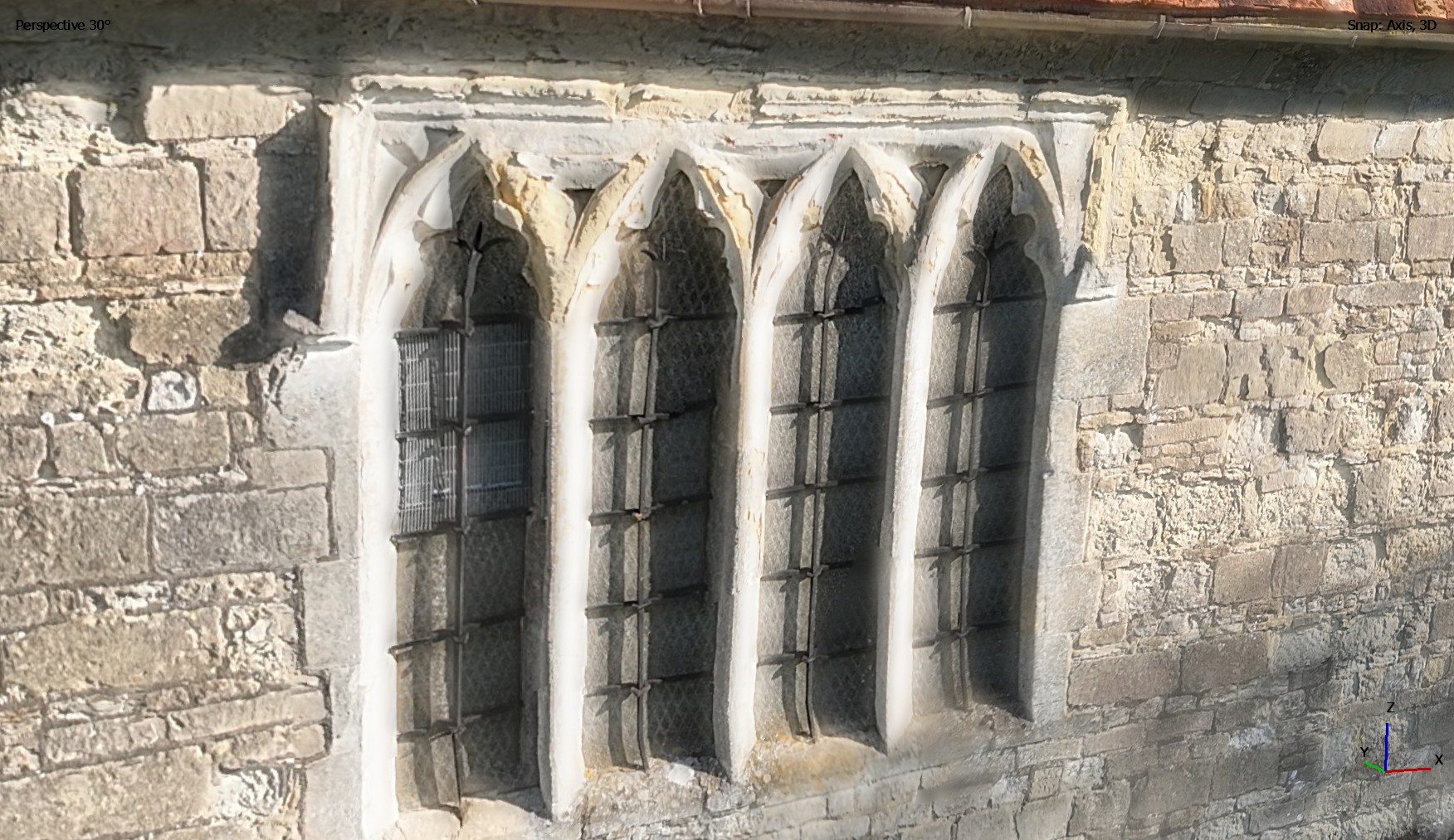
Ground Sampling Distance (GSD) (the size of one pixel) can be between 1-3cm depending on drone flight height.
Data processing after a flight has completed can take approx. 24 hours per 1000 images captured. This will vary depending on the final product requirements. (View Terms of Service Para: 21 for our Statement and Disclosure).
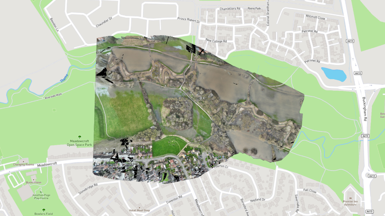
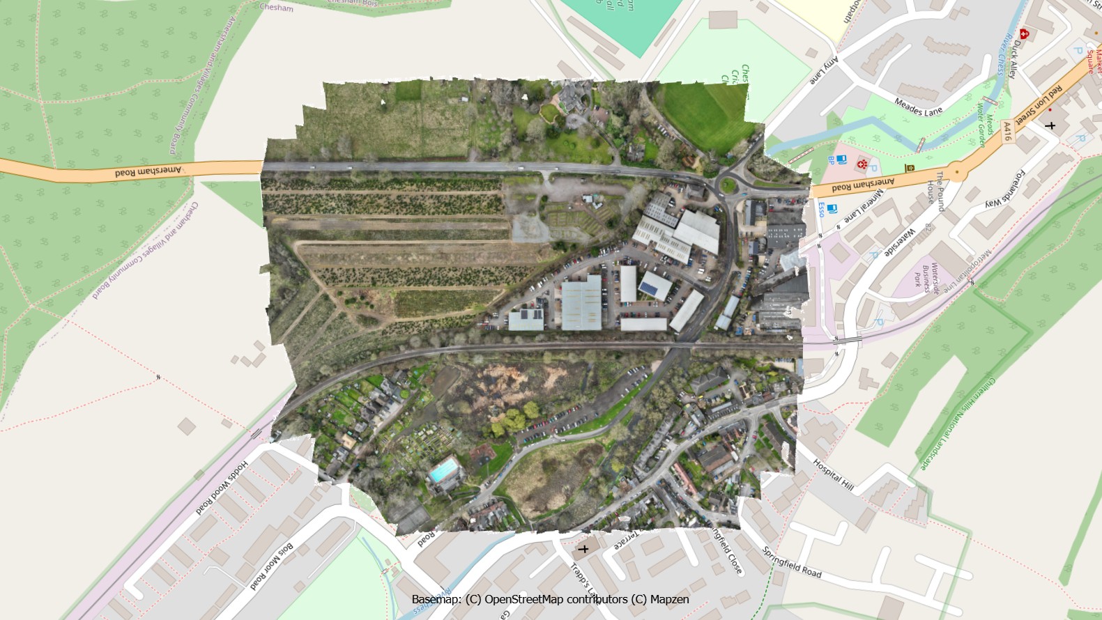
Topographic Survey in 2D / 3D
Prices start from £200 for mapping imagery and processing. Large data sets in the 100s-1000s of images are charged on the total number of images captured and processed.
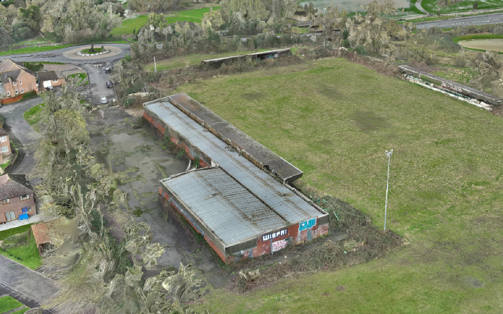
Enhanced 3D Modelling of Buildings
£Request Quote
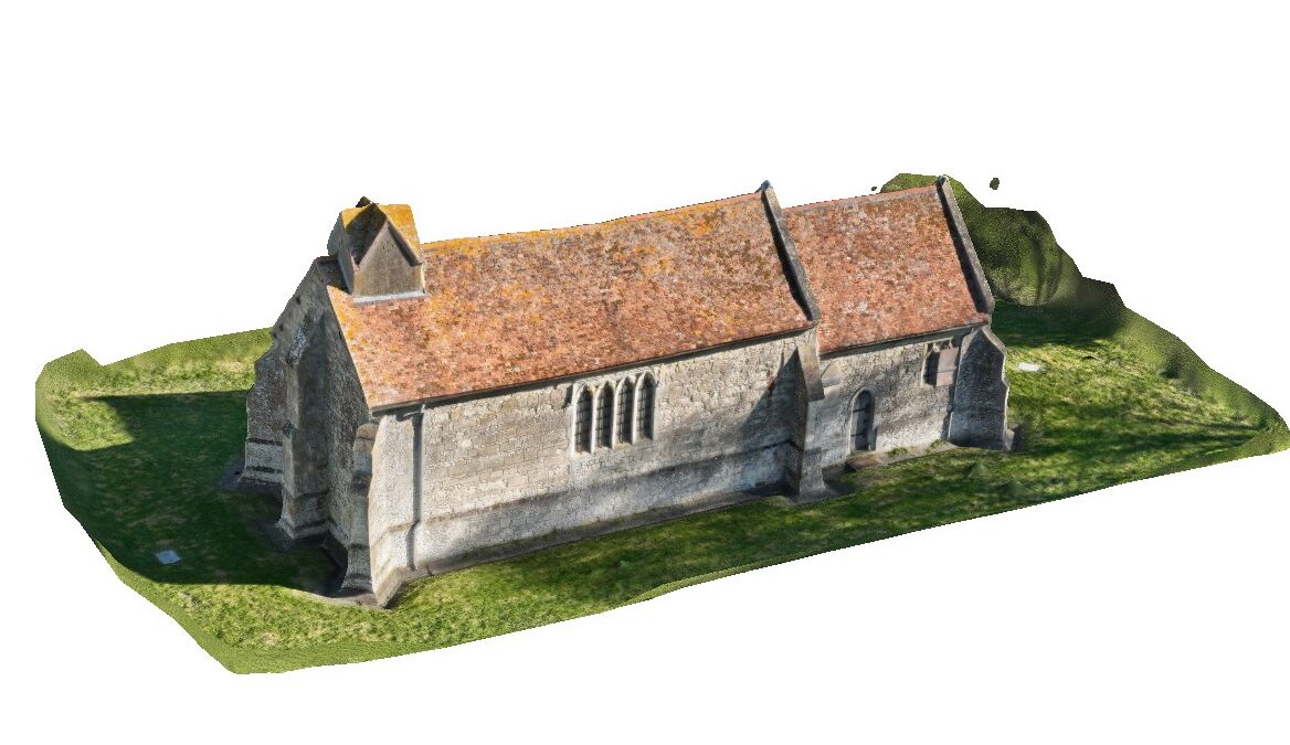
Following a standard survey mission, an advanced drone flight can be conducted to capture intricate details of a building or structure. This process can generate over 1,000 images for a typical building, which are meticulously processed to create highly detailed 3D models. These high-resolution models can then be seamlessly integrated into your systems for in-depth analysis.
RTK Point Positioning
£30
An RTK Module can be used for greater geospatial accuracy of the image data points. RTK high precision GNSS delivers geospatial accuracy from 20cm to 1.5cm. Ground Control Points (GCPs) can be used as well to further refine this if provided by the client. These can also be provided by our trusted partner, who will quote for this service.
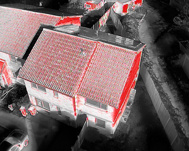
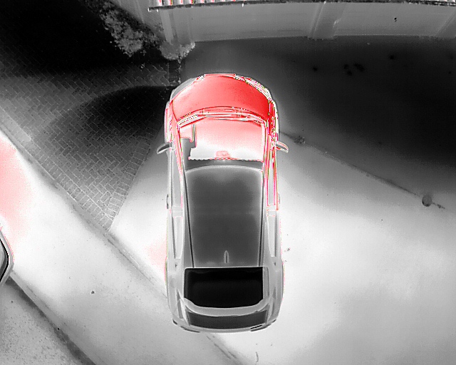
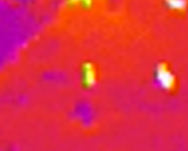
Specialist UAV Drone Thermal Infrared Services
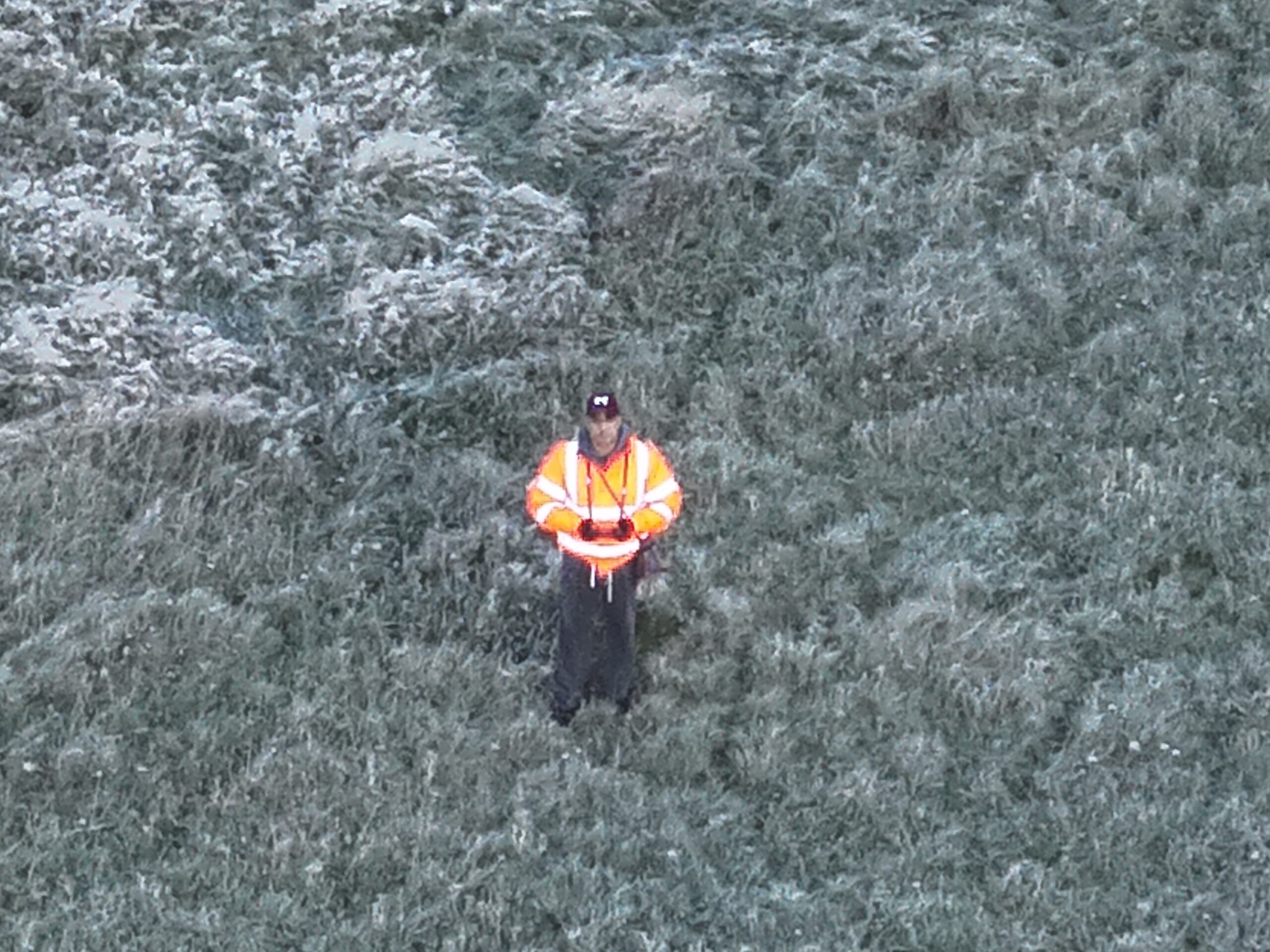
Drone thermal infrared technology refers to the use of drones equipped with infrared cameras that can detect heat signatures. This technology is invaluable in search and rescue operations, building inspections, crowd monitoring by providing a non-invasive means to observe and collect data.
Drone Thermal Infrared Commercial Capture
£200 – 30 mins – Thermal infrared capture Reveal what the eye can’t see — from heat loss patterns to land and area surveys.
Includes:
- Unlimited thermal imagery & video
- Live feed option for client viewing
Perfect for: Building heat loss surveys · Land searches- Creative projects
Drone Thermal Infrared Lost Dog Search and Rescue
Up to £100 – per hour
Unlimited thermal IR search of locations of interest. A downlink computer is provided so that you can see the thermal image and aid in the searching for your dog. This frees up the drone operator to concentrate on navigating the drone and avoiding hazards such as other aircraft. There are enough resources to conduct searches of up to 3 hours if needed. You may be able to claim the cost against your pet insurance policy, Please read this useful article.
Additional Addon Services
360 Panoramic Images
360 Panoramic Images
Included in any package. A fully immersive 360 degree panoramic image that can be scrolled as if you were standing in the centre of that location.
Timelapse Video
From £50
A 5-10 second timelapse video of a point of interest that you have specified. Aerial photography is taken at 2, 3, 4 or 5 second intervals over a set period of time.
Aerial Video Editing
£50 per hour worked
Editing of aerial video clips to compile a captivating 15, 30, 60 + second feature video you can share on your marketing channels.
All packages include reasonable flight planning. Mileage rate is 90p per mile. Media can be delivered in processed and DNG/RAW formats. Submission of an FRZ Non-Standard Flight request to fly in a restricted area; such as near an airfield or prison will incur an additional charge of £40. This is a legal requirement and will ensure that the flight is conducted according to CAA regulations.
All packages include £2m liability insurance as standard this can be increased to £10m if requested.
Contact Bitu Williams for a Free Consultation and Quote
Same day flights maybe available
0600 – 2100hrs 7 days a week.
Phone: +447745966840
Email: info@skyeyeimagery.com