
Drone surveying has rapidly become one of the most valuable tools across construction, property, infrastructure, and environmental projects. Whether you’re assessing a roof, mapping a development site, or capturing topographical data, drones deliver a level of speed, safety, and precision that traditional methods simply can’t match.
What Is a Drone Survey?
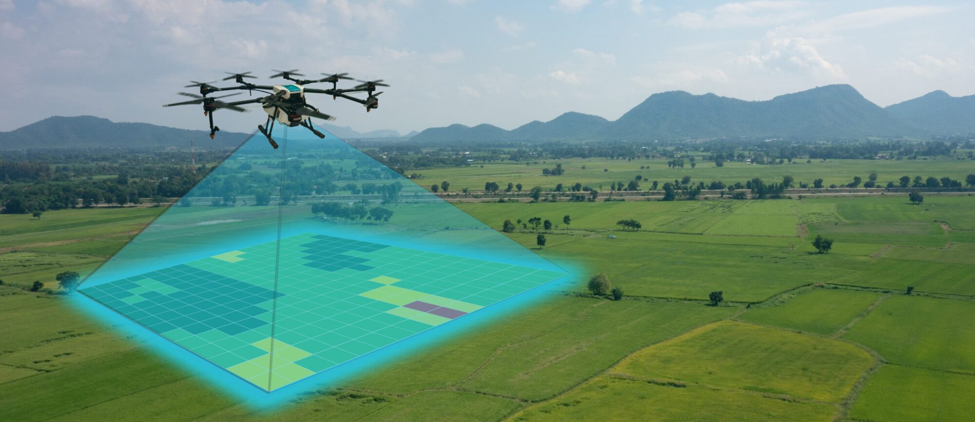
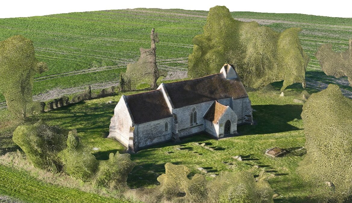
A drone survey uses an unmanned aerial vehicle (UAV) equipped with high‑resolution cameras and sensors to capture detailed imagery and spatial data from above. This data is then processed into outputs such as orthomosaic maps, 3D models, point clouds, elevation maps, and inspection reports.
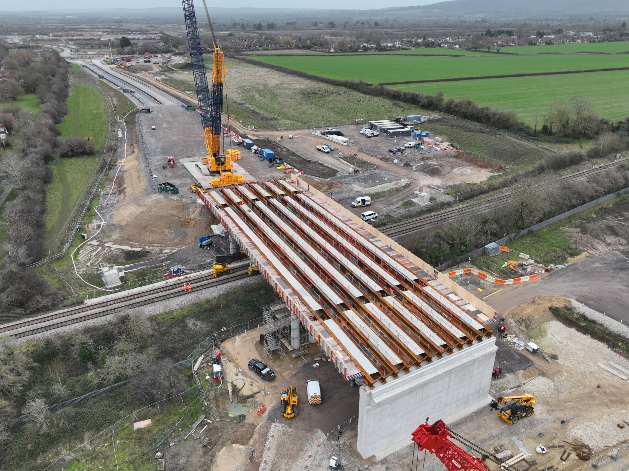
1. Faster Data Collection
Drone surveys dramatically reduce the time required to capture accurate site information.
- Large areas can be surveyed in minutes rather than days
- Rapid deployment means minimal disruption to ongoing work
- Ideal for time‑sensitive projects such as construction progress tracking
This speed allows teams to make quicker decisions and keep projects on schedule.
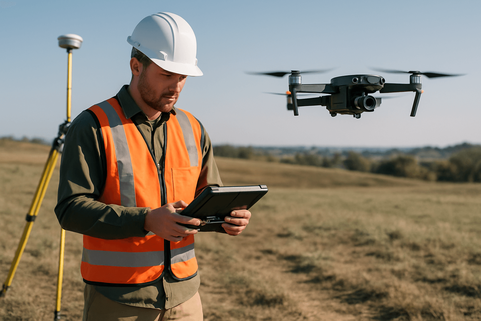
2. Enhanced Safety
One of the biggest advantages of drone surveying is the removal of risk.
- No need for scaffolding, ladders, or working at height
- Hazardous or unstable areas can be inspected from a safe distance
- Perfect for roof inspections, quarries, railways, and live construction sites
By keeping personnel on the ground, drone surveys significantly reduce the likelihood of accidents.
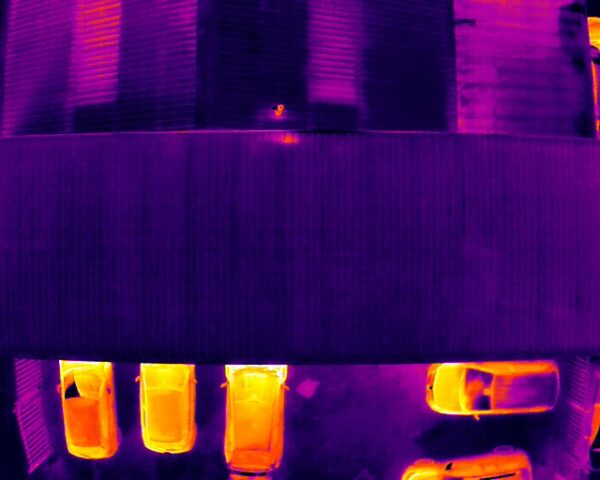
3. High‑Accuracy Data
Modern drones capture incredibly precise measurements thanks to advanced sensors and GPS technology.
- Centimetre‑level accuracy with RTK/PPK systems
- Detailed 3D models and digital elevation data
- Consistent, repeatable results for long‑term monitoring
This accuracy is essential for planning, engineering, and compliance documentation.
4. Access to Hard‑to‑Reach Areas
Drones excel in environments that are difficult, dangerous, or impossible to access on foot.
- Steep roofs
- Fragile structures
- Dense vegetation
- Large industrial sites
- Remote or uneven terrain
This makes them ideal for inspections, mapping, and environmental monitoring.
5. Cost‑Effective Compared to Traditional Methods
Drone surveys reduce or eliminate many of the costs associated with manual surveying.
- No scaffolding or access equipment
- Fewer personnel required
- Faster data capture reduces labour hours
- Lower operational downtime
The result is a more affordable, efficient workflow without compromising quality.
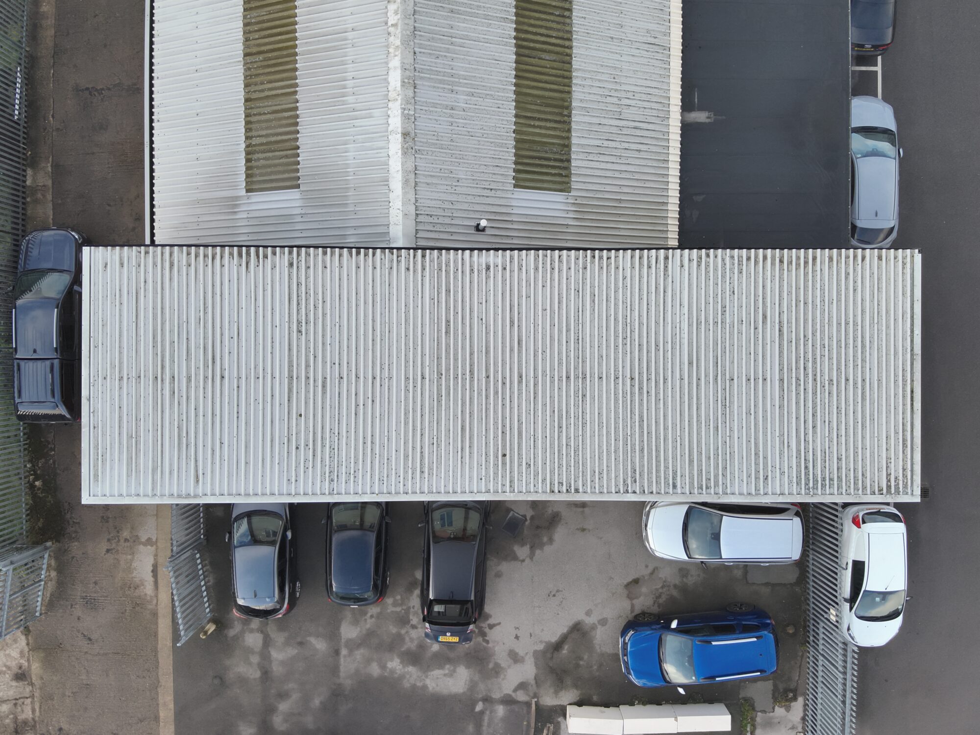
6. High‑Resolution Imagery & Visual Documentation
Drones provide crystal‑clear aerial imagery that enhances understanding and communication.
- Orthomosaic maps
- 4K/6K photography
- 3D visualisations
- Progress documentation for stakeholders
These visuals are invaluable for planning, marketing, and reporting.
7. Environmentally Friendly
Drone surveys have a much smaller environmental footprint.
- Reduced vehicle use
- Minimal ground disturbance
- Ideal for ecological monitoring and land management
They offer a sustainable alternative to traditional surveying methods.
8. Versatile Applications Across Industries
Drone surveys are used in:
- Construction & civil engineering
- Roofing & property inspections
- Agriculture & land management
- Utilities & infrastructure
- Environmental monitoring
- Real estate & marketing
Their adaptability makes them a powerful asset for any project requiring accurate spatial data.
Conclusion
Drone surveys are transforming the way data is captured, analysed, and used across the UK. With faster turnaround times, improved safety, high‑precision outputs, and cost savings, they offer clear advantages over traditional surveying methods.
Contact Bitu Williams for a Free Consultation and Quote
Same day flights maybe available
0600 – 2100hrs 7 days a week.
Phone: +447745966840
Email: info@skyeyeimagery.com