Large scale drone photography collection has revolutionised the field of affordable mapping and surveying. A drone survey can provide valuable data for a wide range of projects. Industries that have used Sky Eye Imagery Drone Survey & Mapping Services include.
- Architects
- Surveyors –
- Planning Teams
- Farmers
- Large Land Owners
- Local Historical Record Teams
Drone Survey Aerial Data Collection:
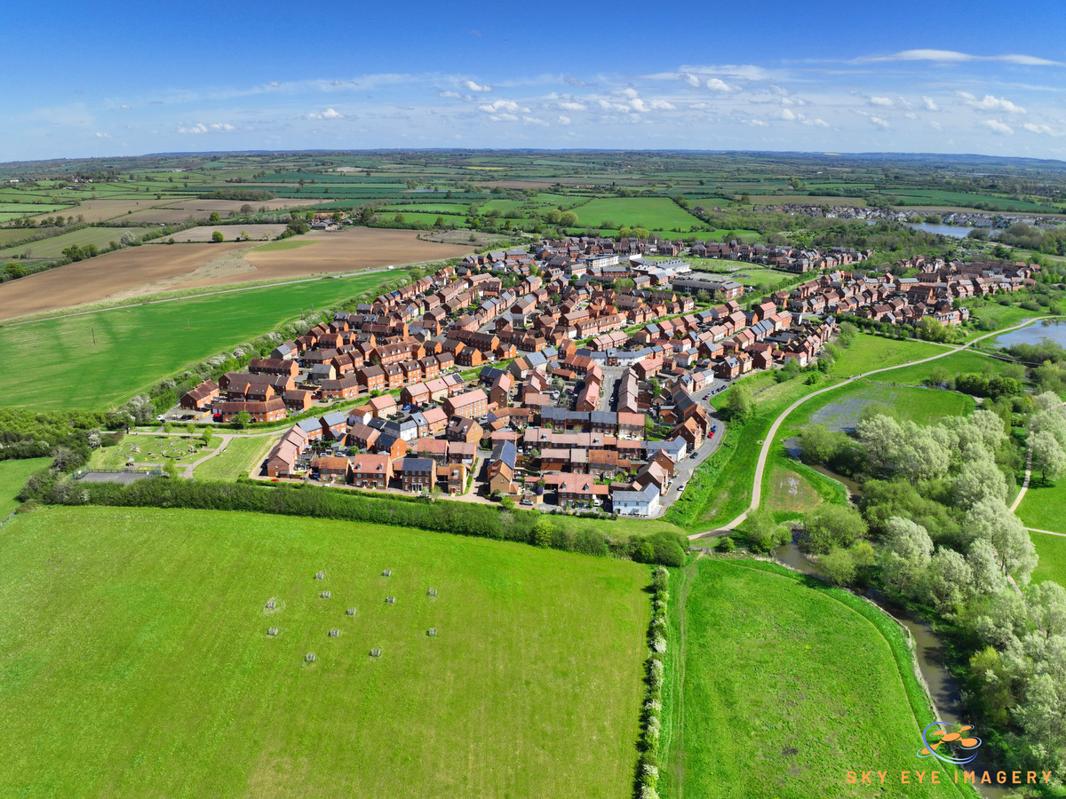
- Our collection of cutting edge aerial survey Drones allow us to collect high-resolution aerial data efficiently and safely.
- The drones can cover large areas and capture 1,000 of aerial photographs in a highly efficient way.
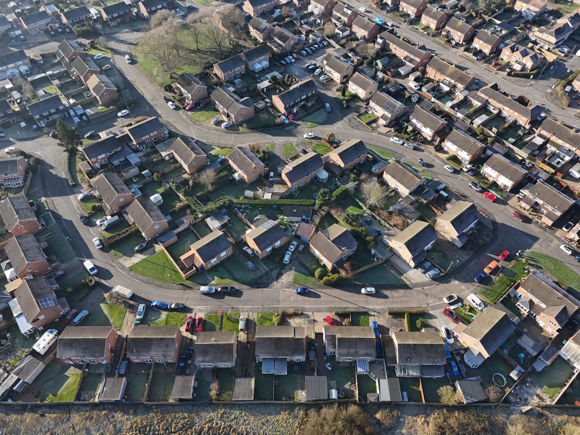
- Sky Eye Imagery uses high-tech drones capable of capturing up to HD survey imagery with GSD down to 1cm.
- Before the flight takes place, a detailed flight plan is created to ensure that the drone’s flight captures the total area requested.


Requested datasets can be downloaded by clients for use on their systems or processing can be conducted by Sky Eye Imagery with product links sent out. The links will allow you to utilise our powerful mapping and drone survey tool which allows you to inspect, measure, annotate and export into reports that can share with clients.
Drone Survey Mapping and Models:
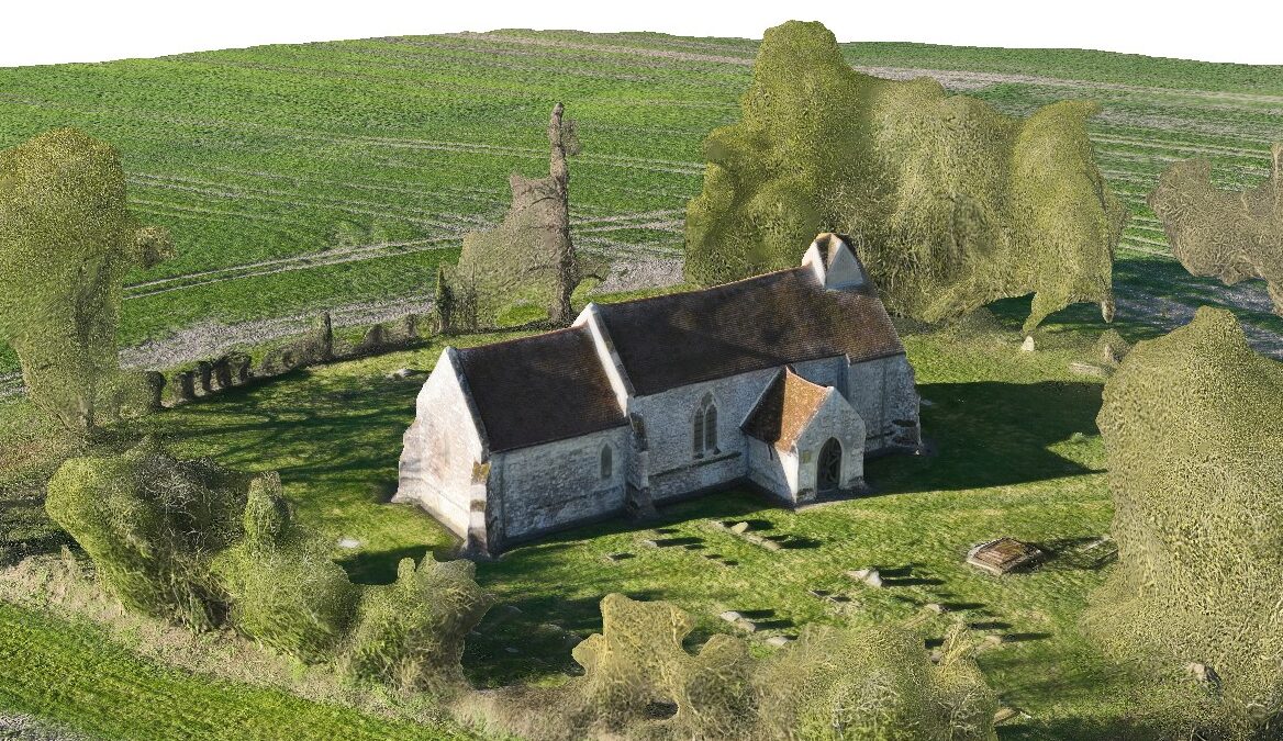
- Our drones can capture high-resolution oblique imagery that can be used to produce 3D maps and interactive models for site appreciation. Imagery is taken from a number of angles to ensure that sufficient overlap is maintained. This helps to deliver an immersive 3D models that can be easily navigated.
- Our models have practical applications in various fields, including construction site surveys, topographic mapping, environmental monitoring, and detailed building inspections.


RTK Positioning
Real-time kinematic positioning (RTK) is the process used to refine geospatial data whilst the drone survey is being conducted. The drone takes GNSS location data along with RTK ground positioning data that helps to refine the position of each pixel. When the photogrammetry process is conducted, location accuracy can be reduced to sub-1.0cm. With the aid of Ground Control Points (GCPS) this can be refined even further. This means that drone survey images can have highly accurate architecture plans laid on top without any adjustments necessary.
Contact Bitu Williams for a Free Consultation and Quote
Same day flights maybe available
0600 – 2100hrs 7 days a week.
Phone: +447745966840
Email: info@skyeyeimagery.com
Email: skyeyeimageryuk@gmail.com