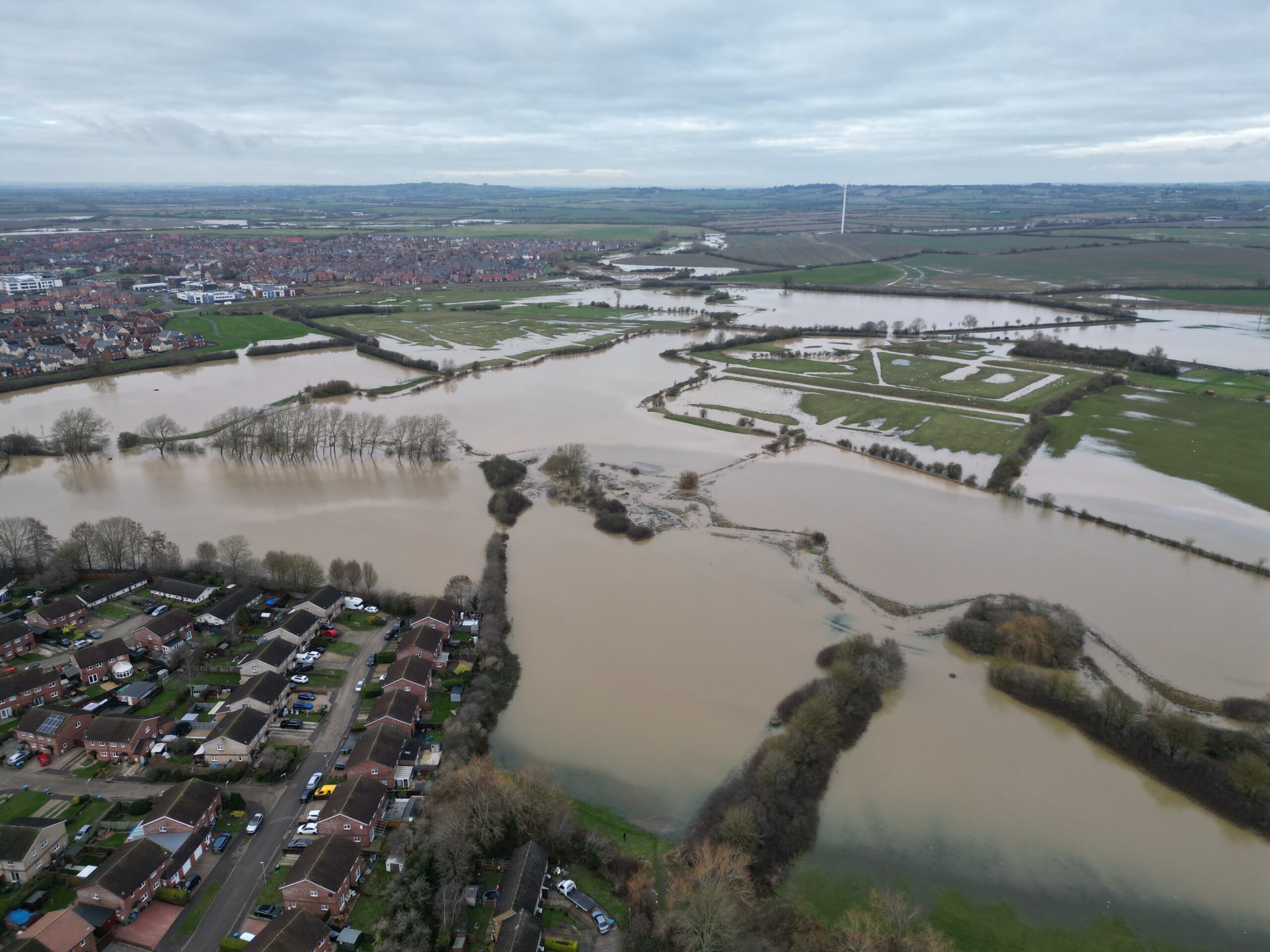
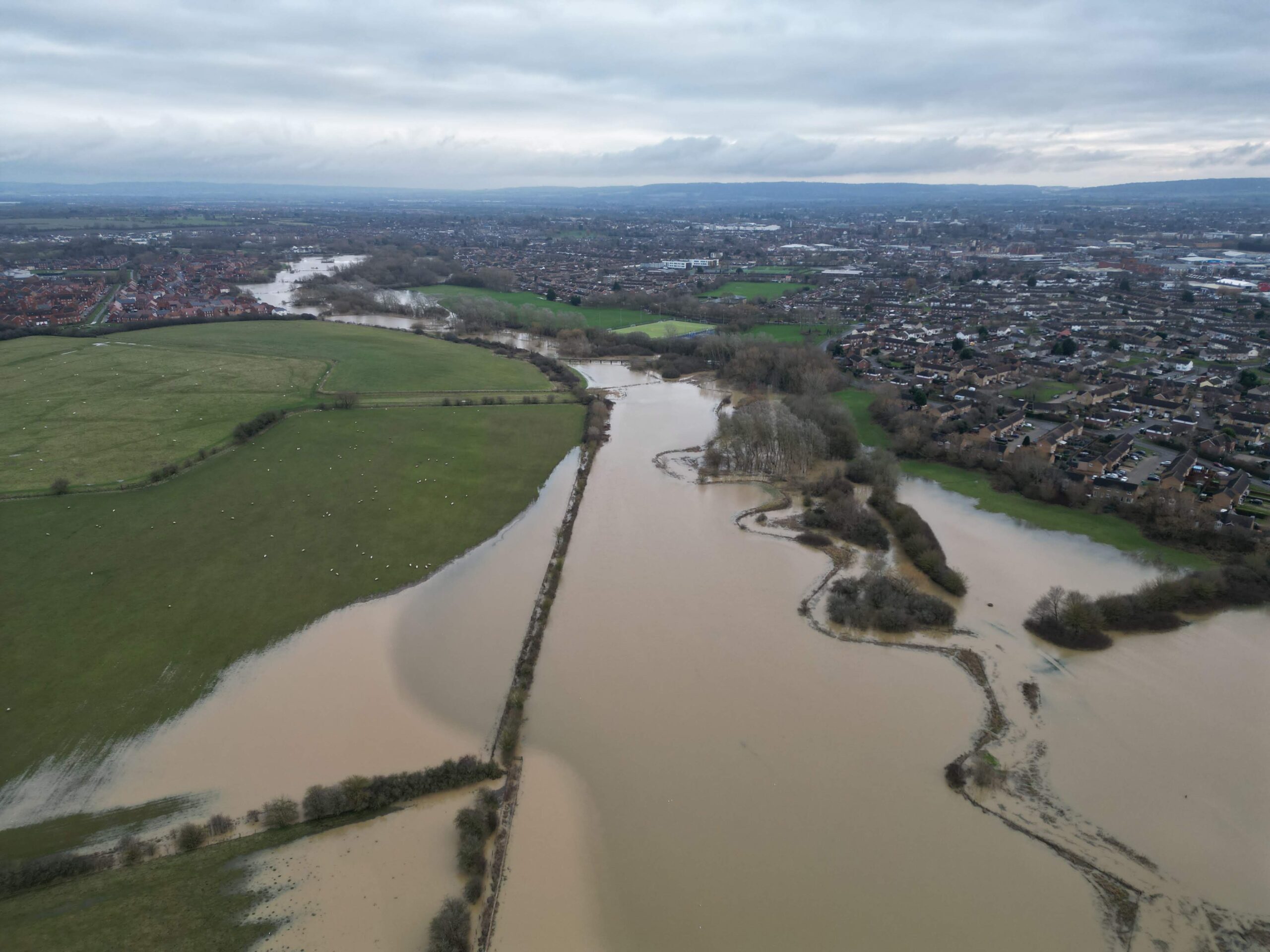
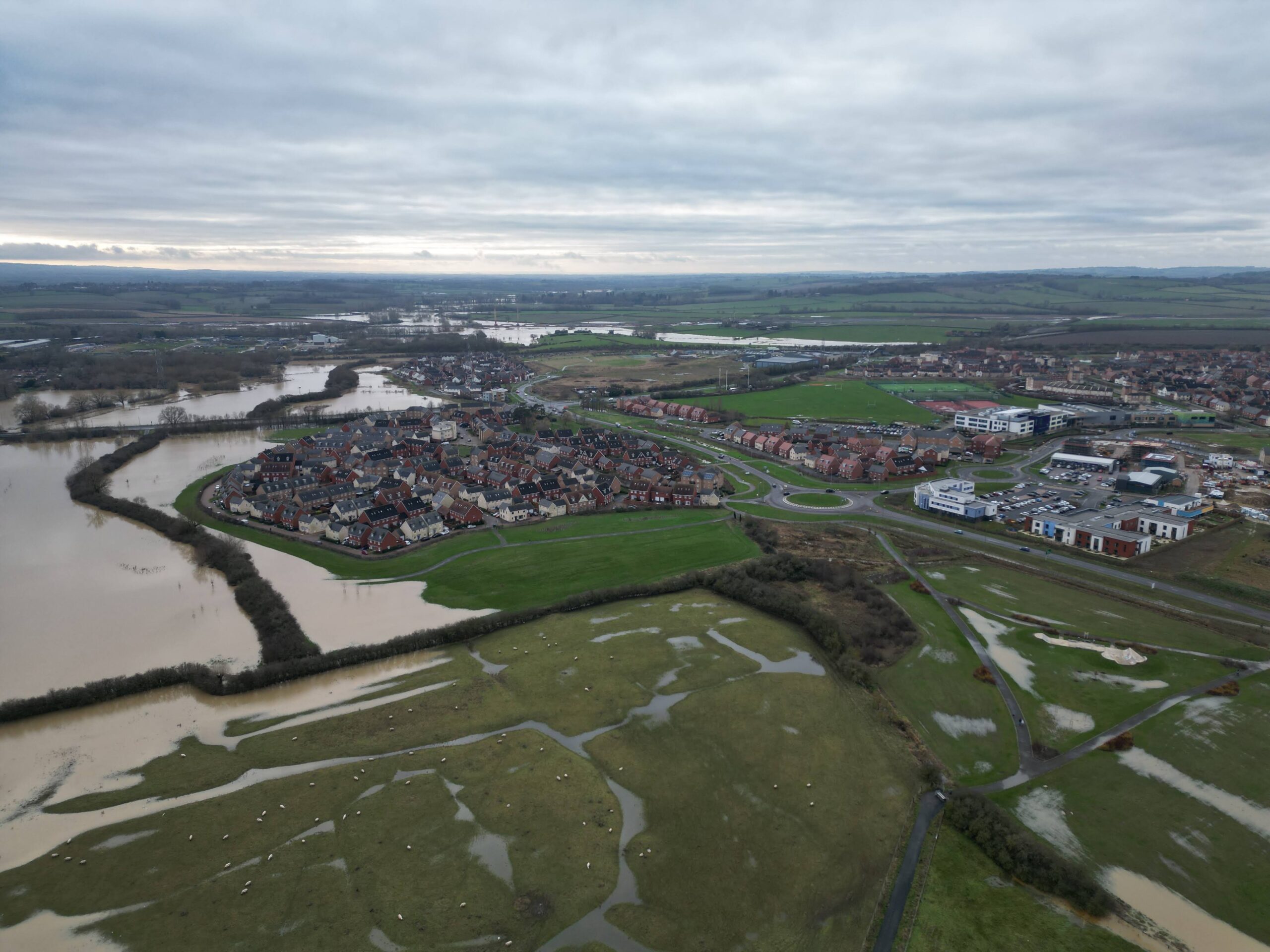
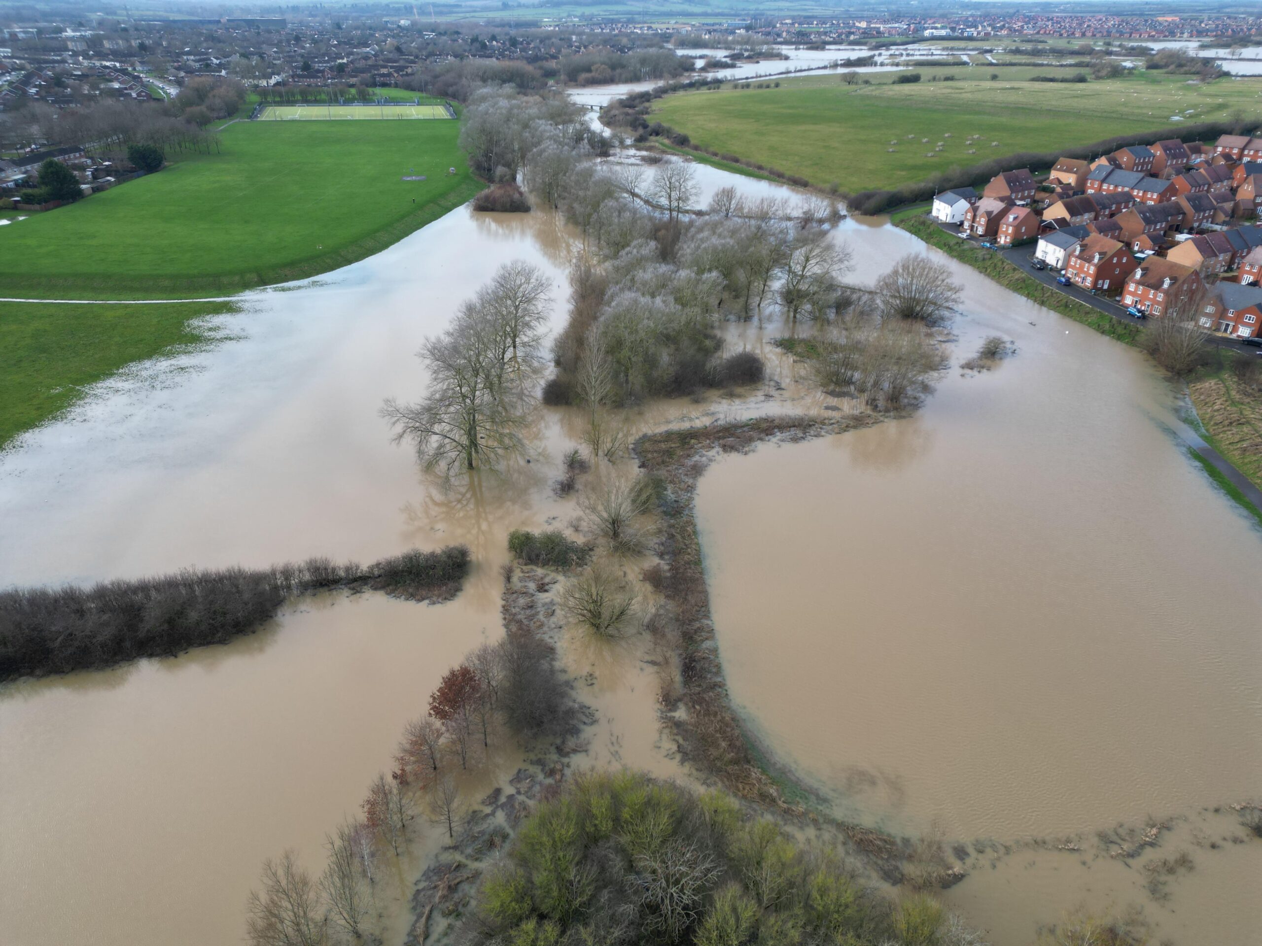
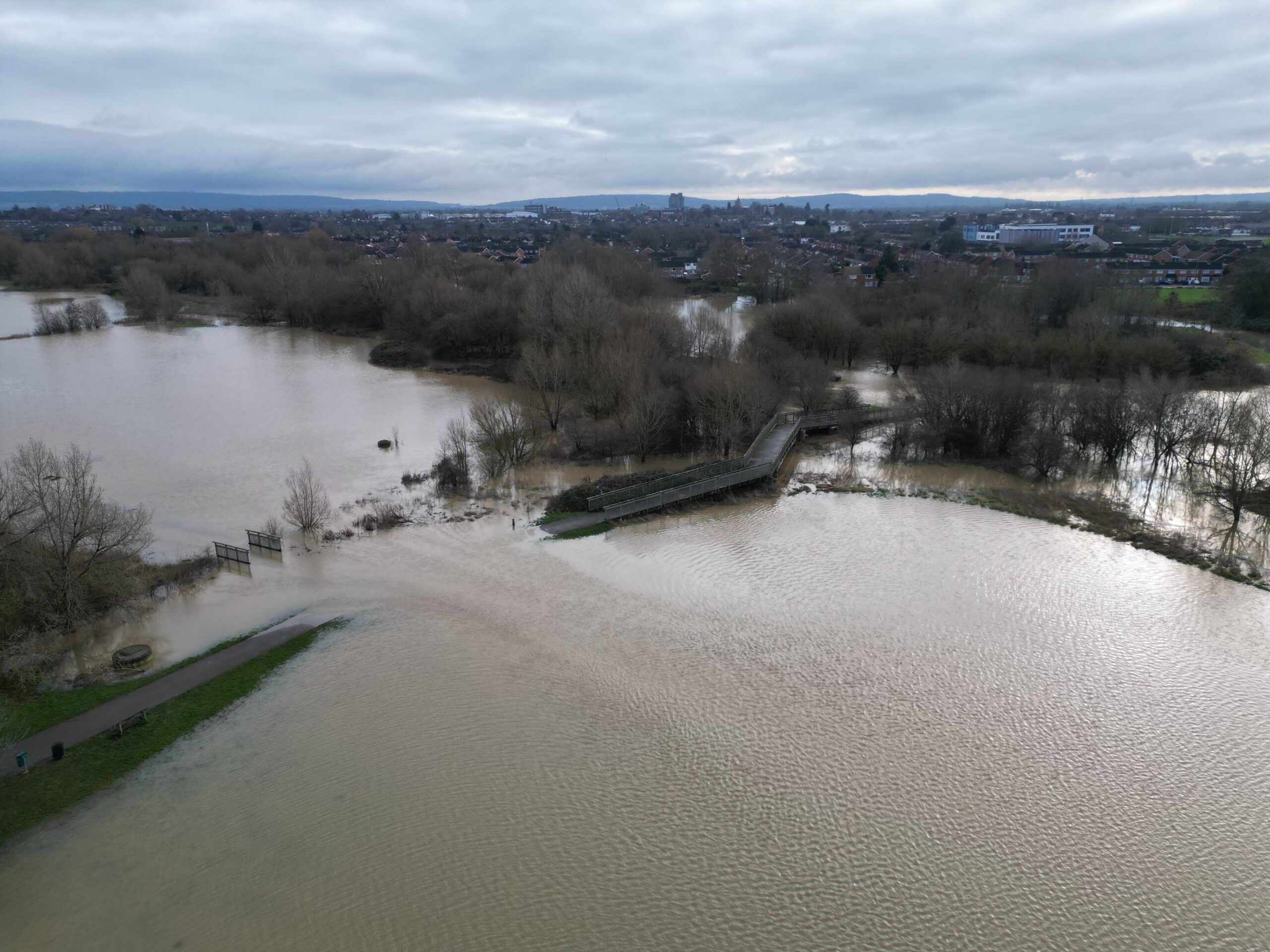
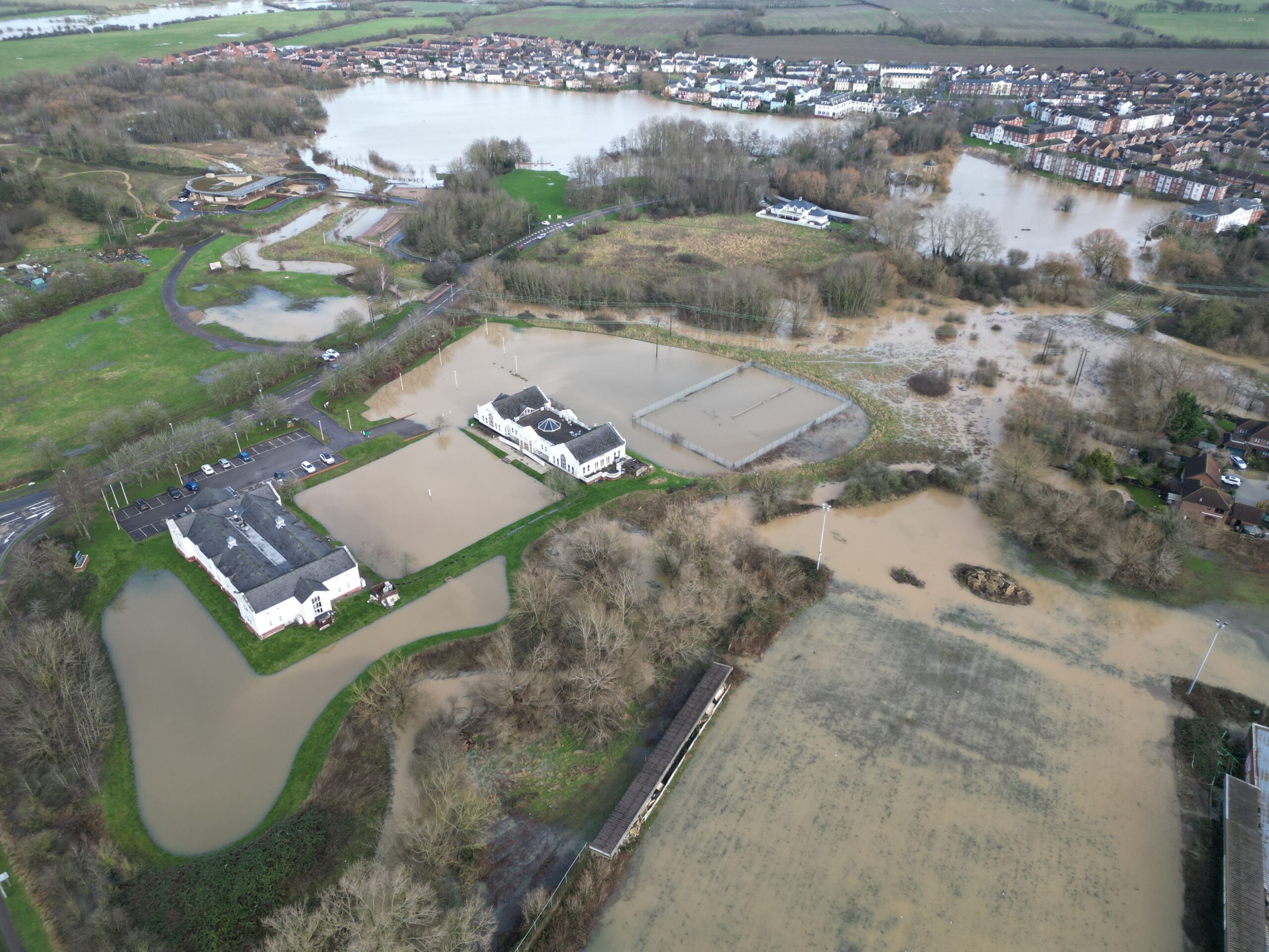
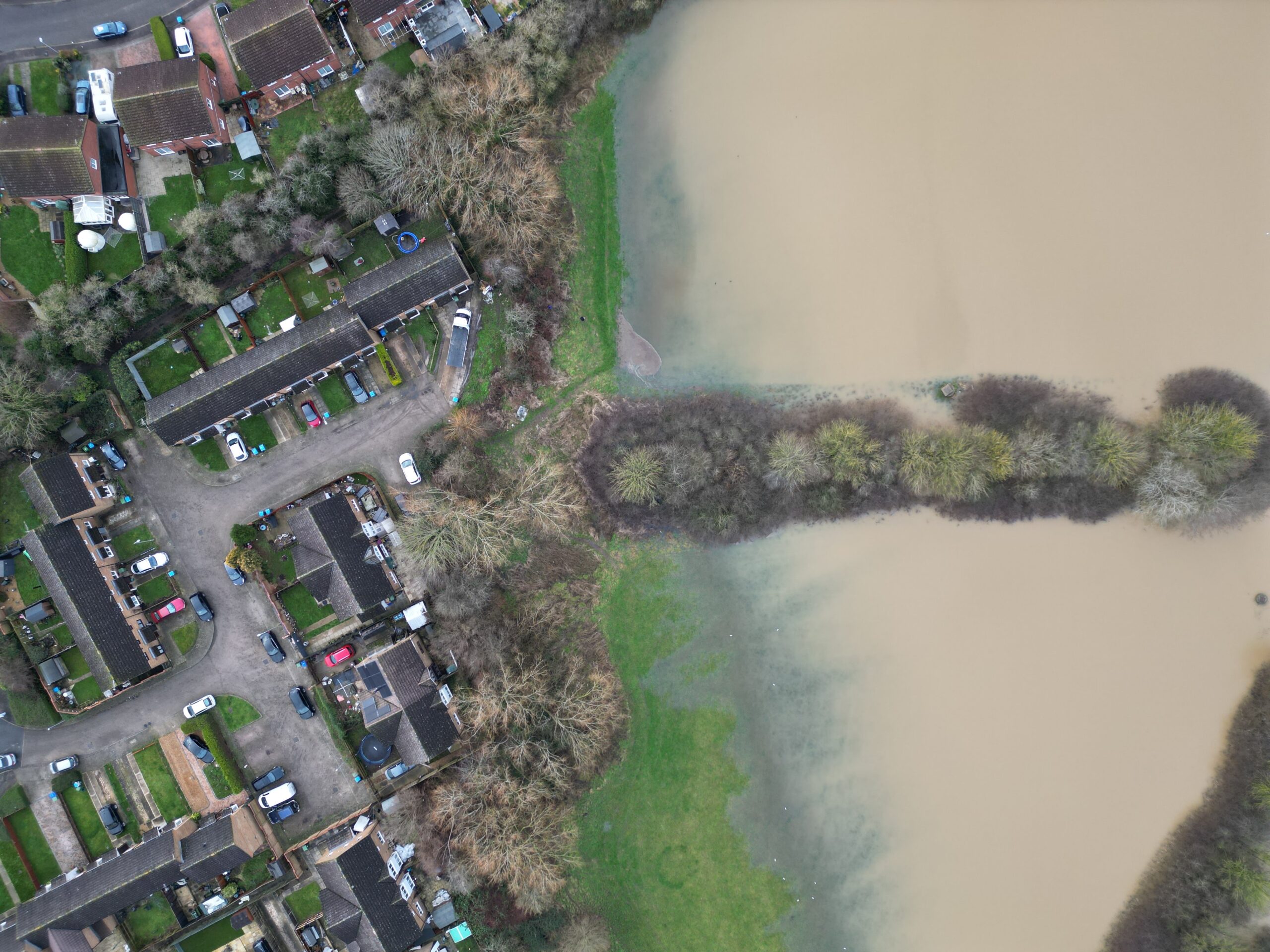
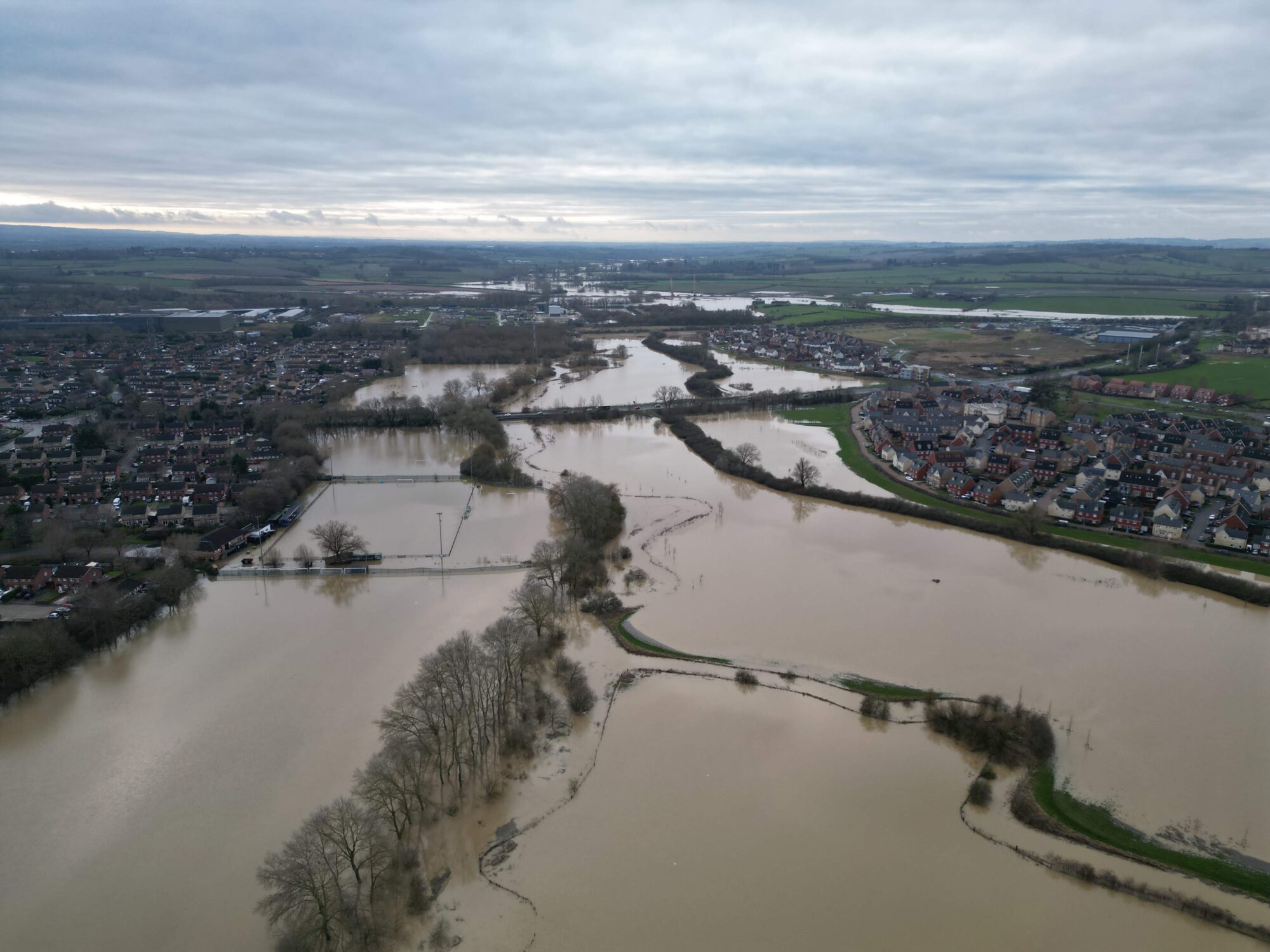
It has been raining hard around the Aylesbury area since #stormhenk and the floodplains are working very hard at keep the waters away from the build up areas of the town. The River Thame has been completely submerged. The beauty of drone imagery and video is that you can see see exactly what the Aylesbury flood water is doing. The main footbridge through Buckingham Park is completely cut off and you would need wellies to get to it. Click on an image to enlarge.
![Drone imagery of flood waters. Looking west from Buckingham Park to Berryfields in north Aylesbury. Buckinghamshire. By skyeyeimagery.com](https://i0.wp.com/skyeyeimagery.com/wp-content/uploads/2024/01/dji_fly_20240105_124322_917_1704459158001_photo.jpg?resize=950%2C713&ssl=1)
![Drone imagery of flood waters. Flood waters in Quarrendon looking north to the Berryfields Wind Turbine in north Aylesbury. By skyeyeimagery.com](https://i0.wp.com/skyeyeimagery.com/wp-content/uploads/2024/01/dji_fly_20240105_132418_925_1704461880573_photo.jpg?resize=950%2C713&ssl=1)
![Drone imagery of flood waters. Stretch of flood water separating Haydon Hill and Berryfields in north Aylesbury. This area is usually green fields. The floodplains are working hard. By skyeyeimagery.com](https://i0.wp.com/skyeyeimagery.com/wp-content/uploads/2024/01/dji_fly_20240105_132704_929_1704461864897_photo-7.jpg?resize=950%2C713&ssl=1)
![Drone imagery of flood waters. Drone view from Berryfields looking west to Buckingham Park in north Aylesbury. By skyeyeimagery.com](https://i0.wp.com/skyeyeimagery.com/wp-content/uploads/2024/01/dji_fly_20240105_132724_930_1704461864726_photo-6.jpg?resize=950%2C713&ssl=1)
![Drone imagery of flood waters. Looking from Buckingham Park to Berryfields with flood waters encroaching near the housing estate. By skyeyeimagery.com](https://i0.wp.com/skyeyeimagery.com/wp-content/uploads/2024/01/dji_fly_20240105_133012_932_1704461850986_photo.jpg?resize=950%2C713&ssl=1)
![Drone imagery of flood waters. Looking west from Buckingham Park to Berryfields in north Aylesbury. Buckinghamshire. By skyeyeimagery.com](https://i0.wp.com/skyeyeimagery.com/wp-content/uploads/2024/01/dji_fly_20240105_124600_919_1704459147226_photo.jpg?resize=950%2C713&ssl=1)
![Drone imagery of flood waters. Image of Buckingham Park floodplain looking east to west in north Aylesbury. By skyeyeimagery.com](https://i0.wp.com/skyeyeimagery.com/wp-content/uploads/2024/01/dji_fly_20240105_125234_923_1704459138913_photo.jpg?resize=950%2C713&ssl=1)
![Drone imagery of flood waters. The footbridge in Buckingham Park in north Aylesbury is cut off by flood waters. By skyeyeimagery.com](https://i0.wp.com/skyeyeimagery.com/wp-content/uploads/2024/01/dji_fly_20240105_124658_920_1704459147076_photo.jpg?resize=950%2C713&ssl=1)
![Drone imagery of flood waters. Garden Court Hotel in Watermead north Aylesbury is surrounded by flood waters, but still accessible. By skyeyeimagery.com](https://i0.wp.com/skyeyeimagery.com/wp-content/uploads/2024/01/dji_fly_20240105_125146_922_1704459139092_photo.jpg?resize=950%2C713&ssl=1)
![Drone imagery of flood waters. Overhead view of a housing estate in north Aylesbury. Flood waters in floodplain next to a houses. By skyeyeimagery.com](https://i0.wp.com/skyeyeimagery.com/wp-content/uploads/2024/01/dji_fly_20240105_133422_937_1704461817099_photo-5.jpg?resize=950%2C713&ssl=1)